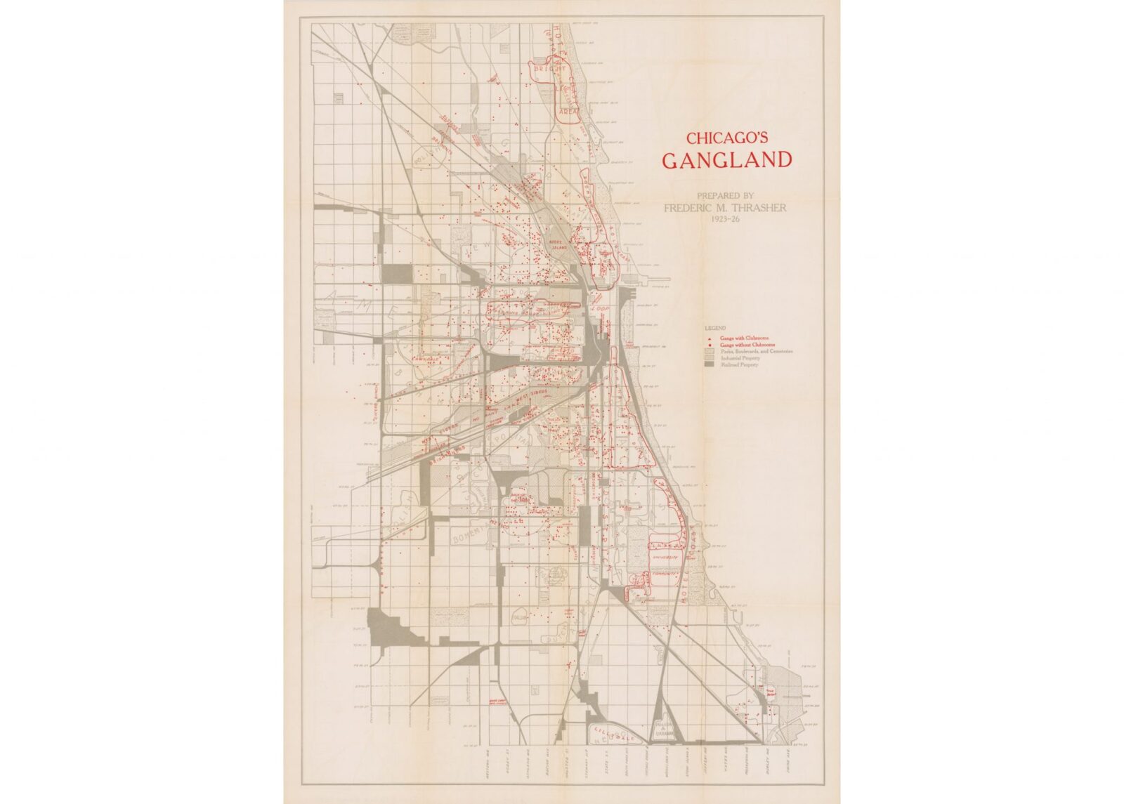
The Chicago Gangland Map was created by Frederic M. Thrasher in 1927, it’s based on 3 years of research between 1923 and 1926 documenting 1,313 active gangs in the Chicago area for his book “The Gang: A Study of 1,313 Gangs in Chicago“.
Thrasher was a sociologist at the University of Chicago and his ability to document not only the territory of hundreds of gangs but also their clubrooms is a testament to his thoroughness (and bravery).
“No less than 1,313 gangs have been discovered in Chicago and its environs! Their distribution as shown on the accompanying map makes it possible to visualize the typical areas of gangland and to indicate their place in the life and organization of Chicago.” – Frederic M. Thrasher
The map has been digitised by the team at Cornell University, at a staggeringly high resolution of 5564px wide and 8037px high (and 300 DPI). Although we haven’t been able to find anyone offering posters of the map for purchase – the resolution and DPI mean it wouldn’t be hard to get your own made, which is allowable for non-commercial purposes under the map’s copyright license which can be read here.
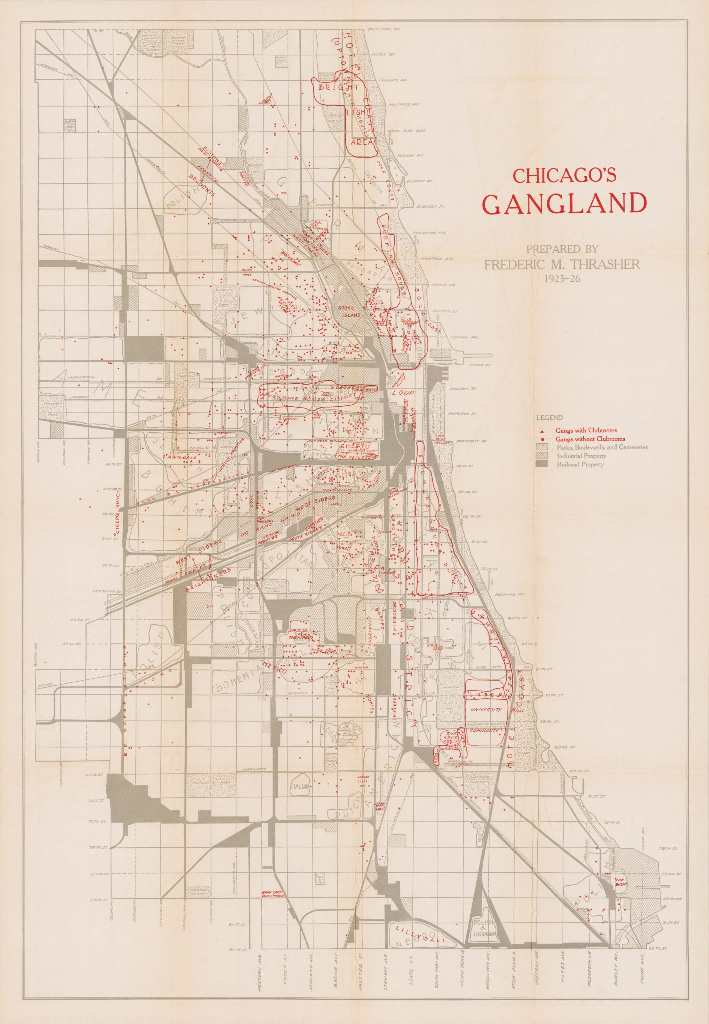
Courtesy of Cornell University – PJ Mode Collection of Persuasive Cartography.
Via Atlas Obscura

Articles that Ben Branch has written have been covered on CNN, Popular Mechanics, Smithsonian Magazine, Road & Track Magazine, the official Pinterest blog, the official eBay Motors blog, BuzzFeed, Autoweek Magazine, Wired Magazine, Autoblog, Gear Patrol, Jalopnik, The Verge, and many more.
Silodrome was founded by Ben back in 2010, in the years since the site has grown to become a world leader in the alternative and vintage motoring sector, with well over a million monthly readers from around the world and many hundreds of thousands of followers on social media.