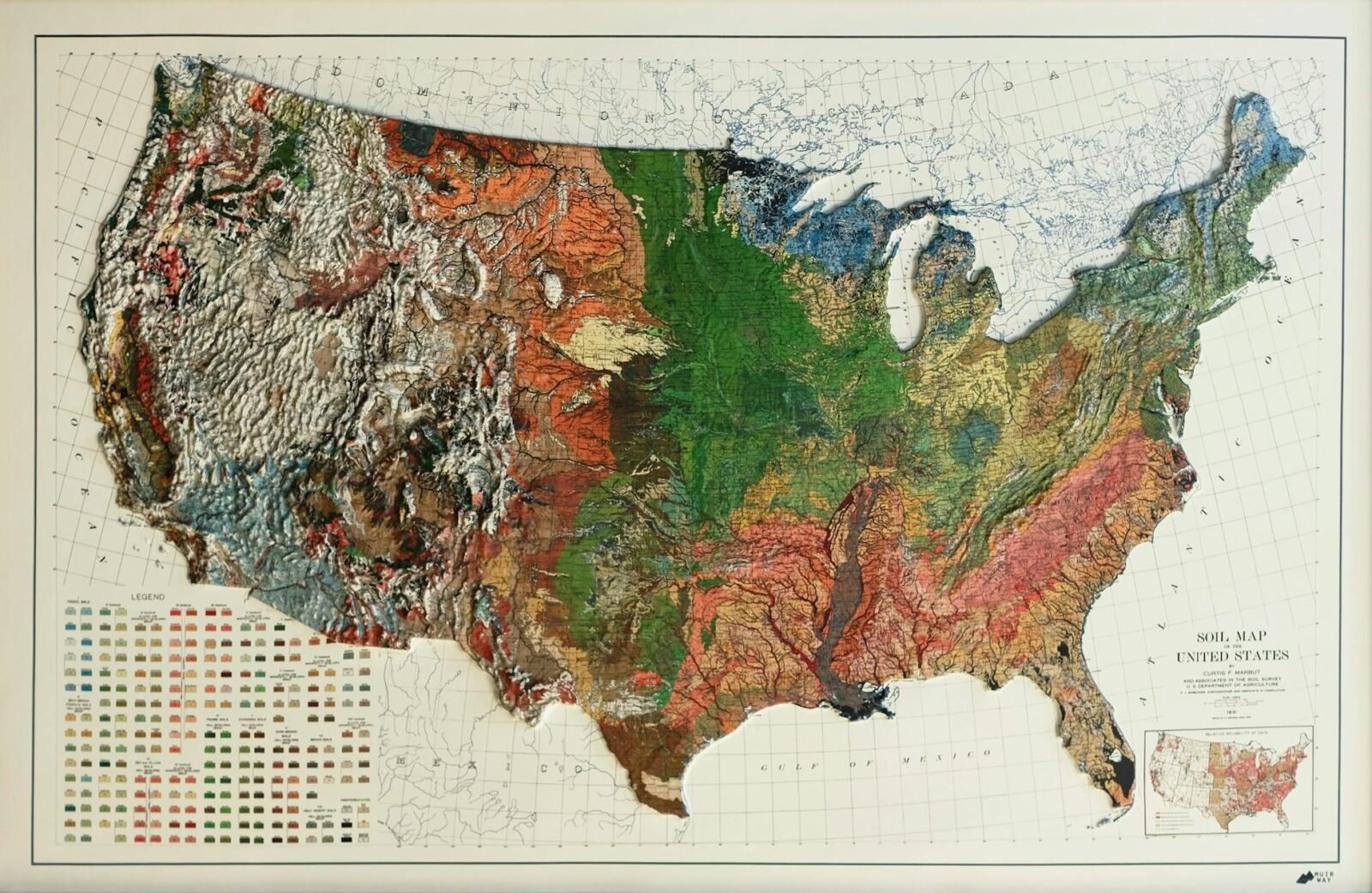
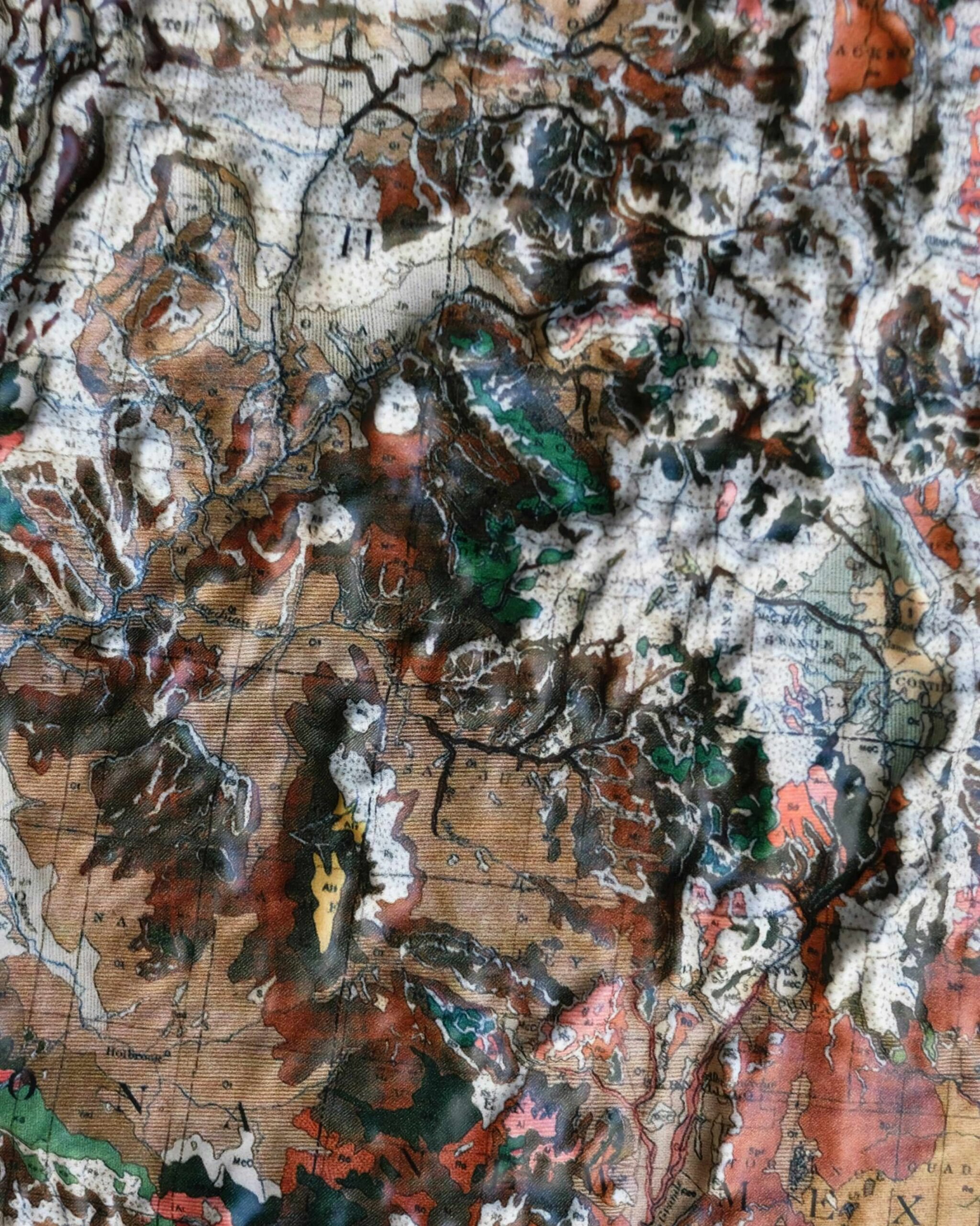
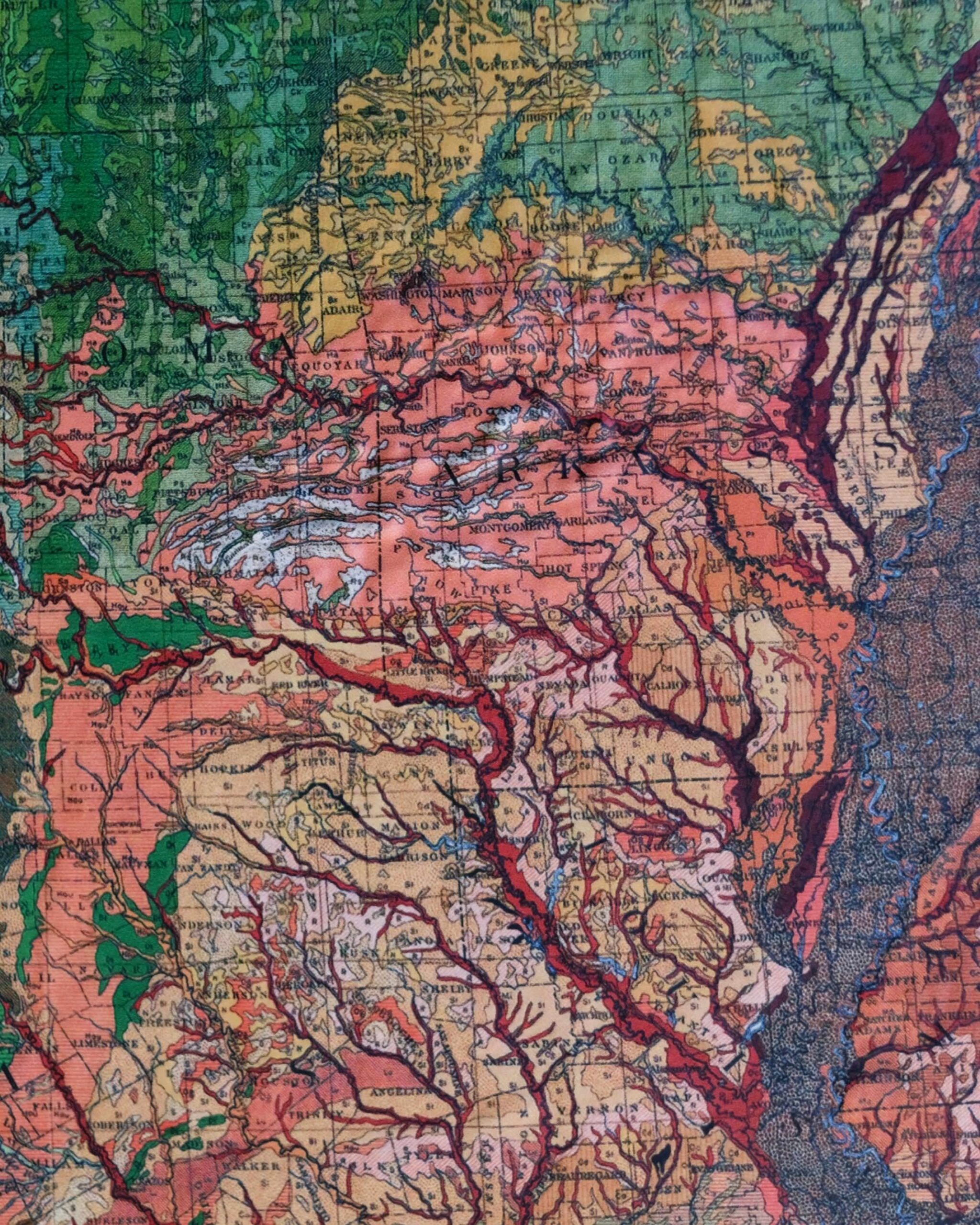
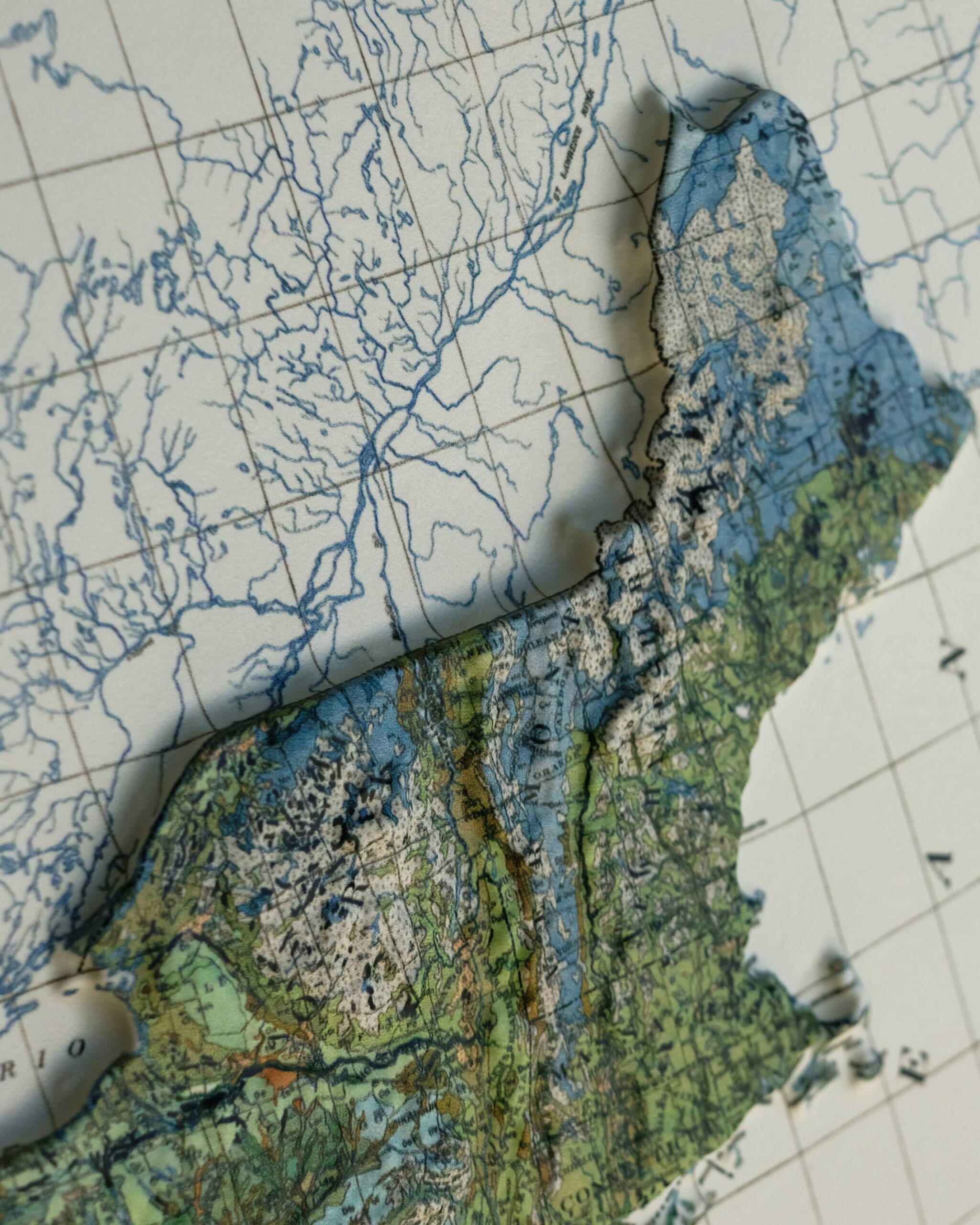
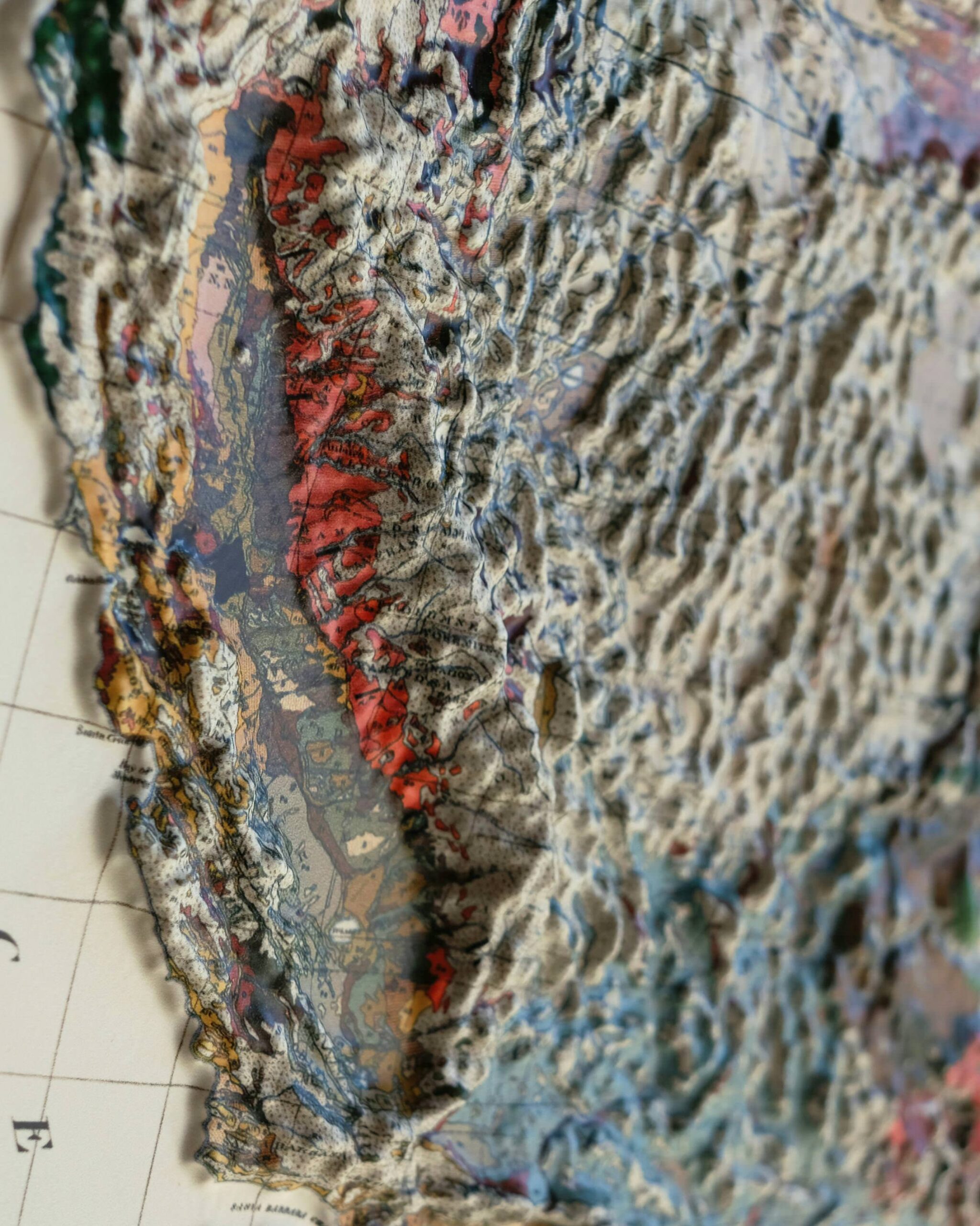
This is a map of the United States that features a raised 3D surfaces, perfectly matched to the geography of the country, allowing you to run your fingers along the surface of the map from Sierra Nevada to the Rocky Mountains and across to the Appalachians.
The map was created by Muir Way, a company that specializes in producing some of the most beautiful maps you’re likely to find anywhere. This series of 3D maps are vacuum-formed over an intricately detailed 3D topographical mold, providing a new way to look at (and feel) maps.
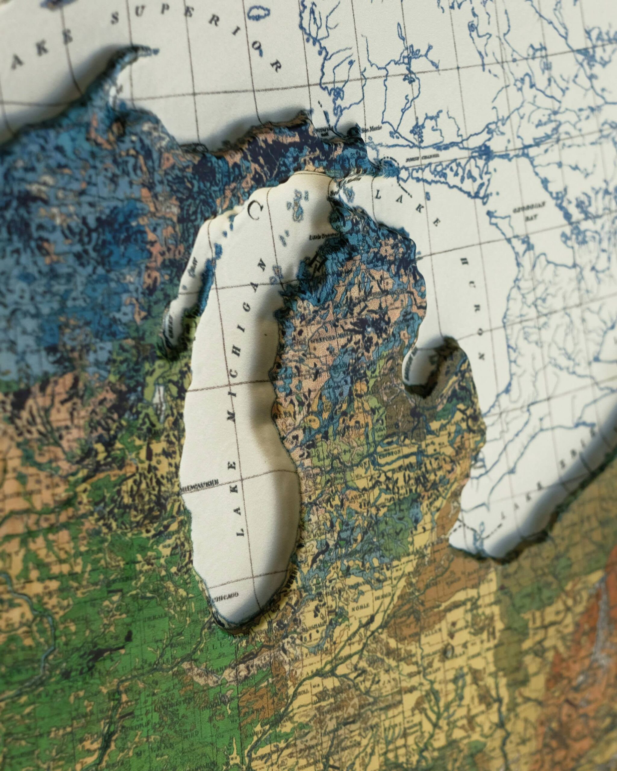
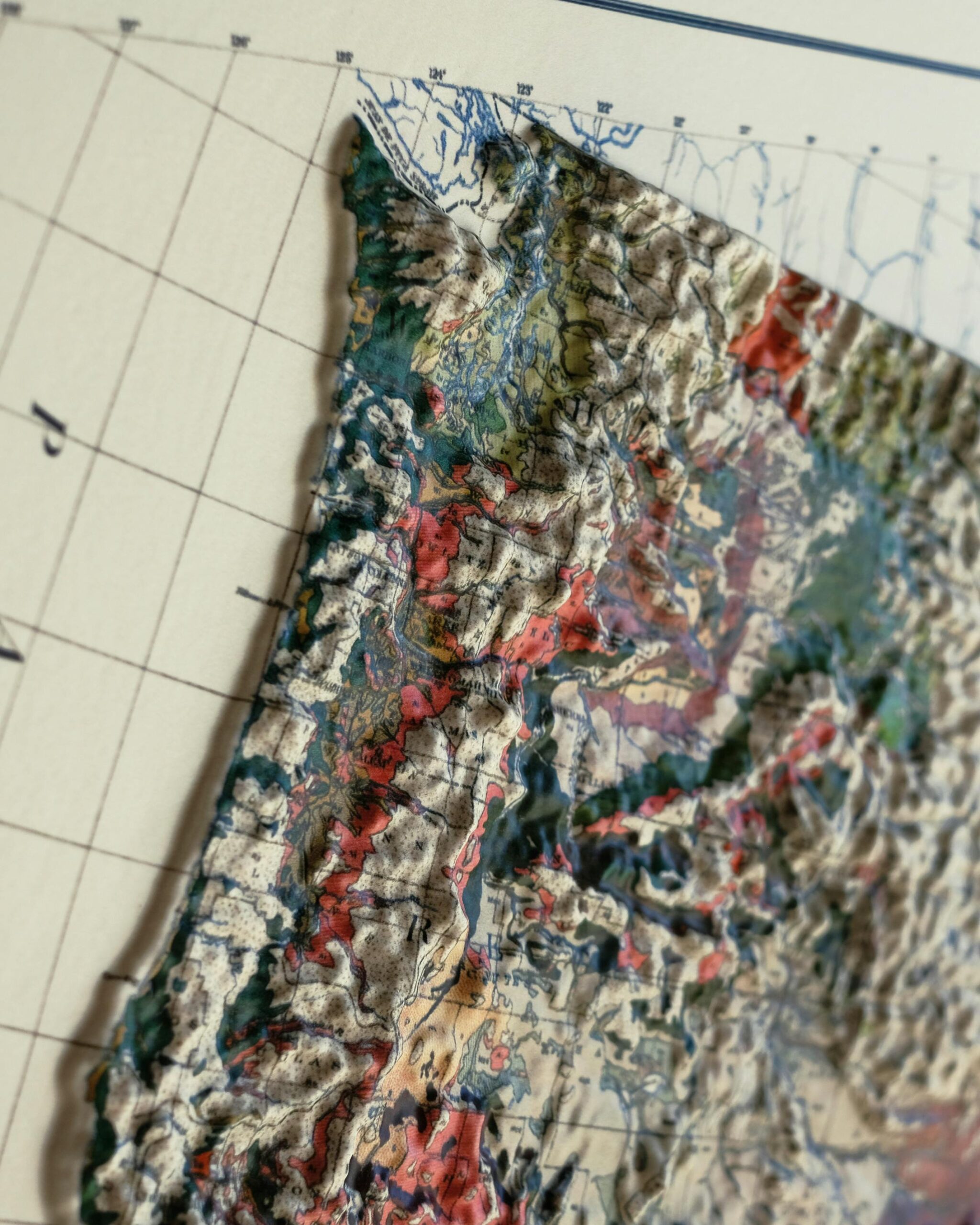
 The USA 1931 3D Raised Relief Map is 3D to the touch, allowing you to actually feel the topographical differences across the United States.
Muir Way was founded by Jared Prince in 2013. Prince is an avid outdoorsman and used to buy paper maps of the wilderness regions he was be traveling through. After trips they would typically end up packed away in boxes gathering dust.
He decided to create a new series of maps that people would put on their walls instead of stuff away in their attics. In the past 11 years, Prince and his team have created hundreds of new map designs of National Parks, mountain ranges, hydrology, historic maps, and more.
Every map that Muir Way produces is printed at their shop in San Diego, California and they work to primarily use materials made in the USA – including the paper, canvas, and wood. A portion of the profits of each map sold go to outdoors-related charities like the Sierra Club Foundation, Leave No Trace, and the Waterkeeper Alliance.
The map shown in this article was made using an original 1931 topographical map of the USA which has been vacuum sealed over a 3D mold cut with precision using NASA elevation data to create the most accurate and detailed map three dimensional map available.
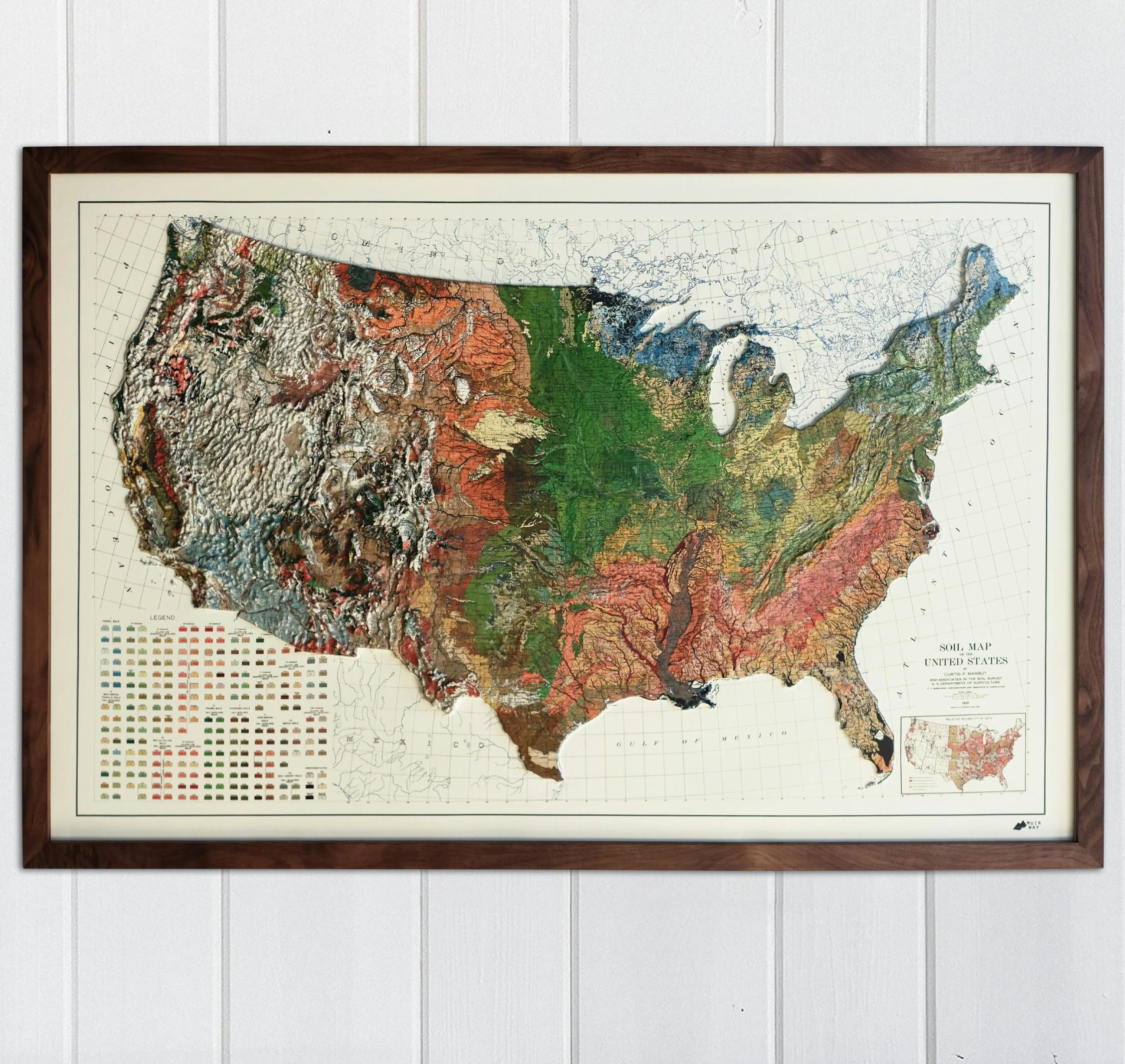
The map is quite large, measuring in at 38”x 25” (3′ 2″ by 2′ 1″), or approximately 96.5 cm by 63.5 cm.
The print measures in at 38”x 25” (3′ 2″ by 2′ 1″), or approximately 96.5 cm by 63.5 cm. The map itself is plastic mounted on a mat board and it comes unframed for easy postage. This map is currently being offered by the outfitters at Huckberry with free US shipping and a best price guarantee for $215 USD.
Images courtesy of Muir Way

Articles that Ben Branch has written have been covered on CNN, Popular Mechanics, Smithsonian Magazine, Road & Track Magazine, the official Pinterest blog, the official eBay Motors blog, BuzzFeed, Autoweek Magazine, Wired Magazine, Autoblog, Gear Patrol, Jalopnik, The Verge, and many more.
Silodrome was founded by Ben back in 2010, in the years since the site has grown to become a world leader in the alternative and vintage motoring sector, with well over a million monthly readers from around the world and many hundreds of thousands of followers on social media.