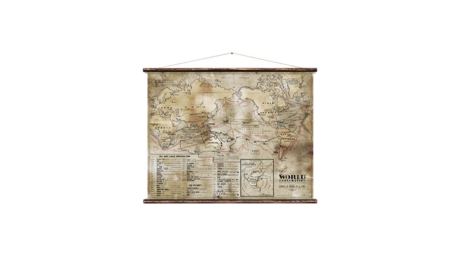
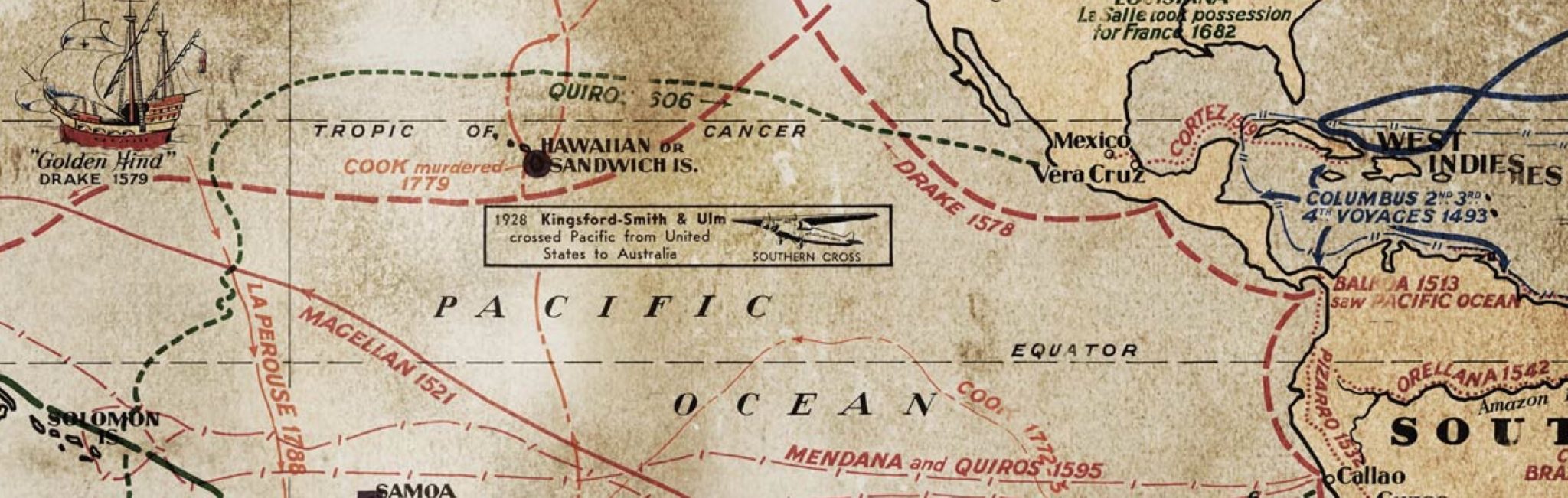
The World Exploration Map by Erstwhile is a reproduction of an original vintage map published by Chas. H. Scally & Co, of New South Wales, Australia. It measures in at 130cm x 106cm, and shows historic routes on land, sea and air, with the inset Map of Antarctica, and a detailed legend showing which routes belong to which explorers.
The map has been reprinted with extreme attention to detail on Airtex canvas, then hand-mounted with aged timber batons and 100% hemp rope – and each is supplied ready to hang.


Articles that Ben has written have been covered on CNN, Popular Mechanics, Smithsonian Magazine, Road & Track Magazine, the official Pinterest blog, the official eBay Motors blog, BuzzFeed, Autoweek Magazine, Wired Magazine, Autoblog, Gear Patrol, Jalopnik, The Verge, and many more.
Silodrome was founded by Ben back in 2010, in the years since the site has grown to become a world leader in the alternative and vintage motoring sector, with well over a million monthly readers from around the world and many hundreds of thousands of followers on social media.