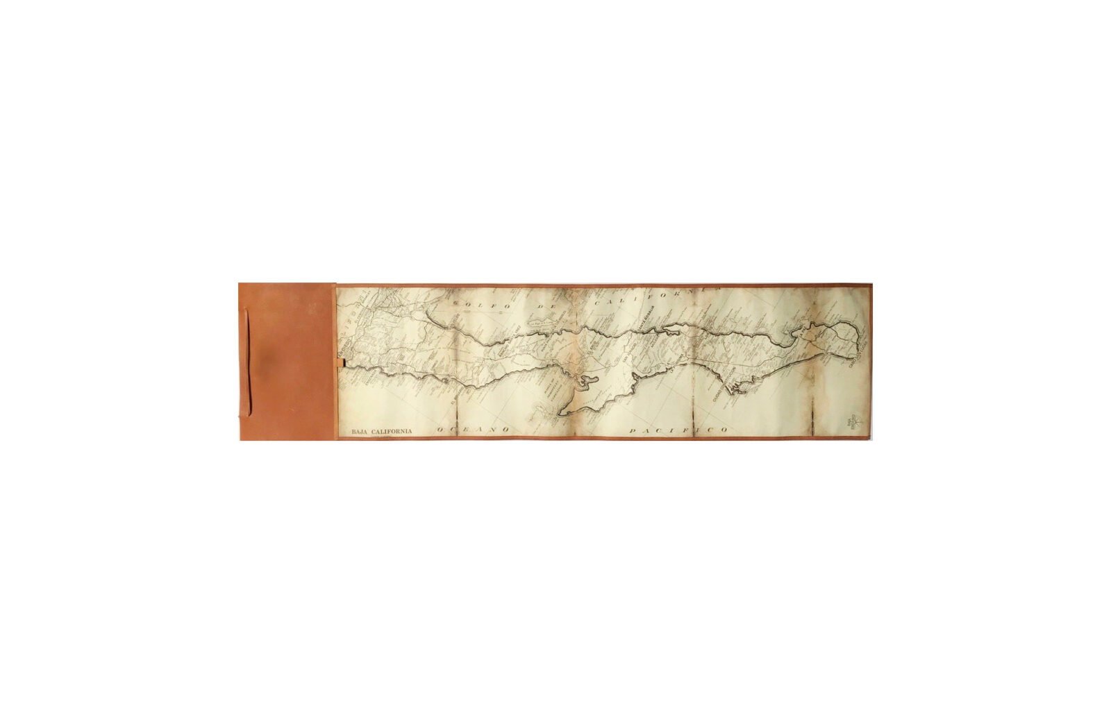
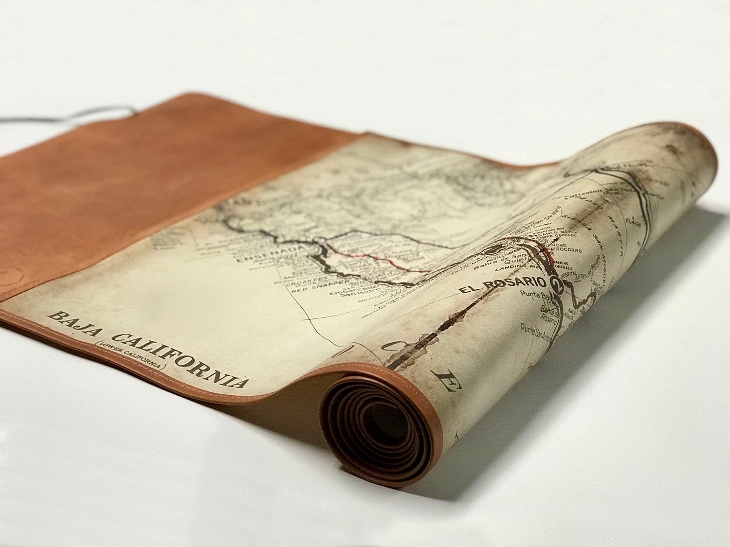
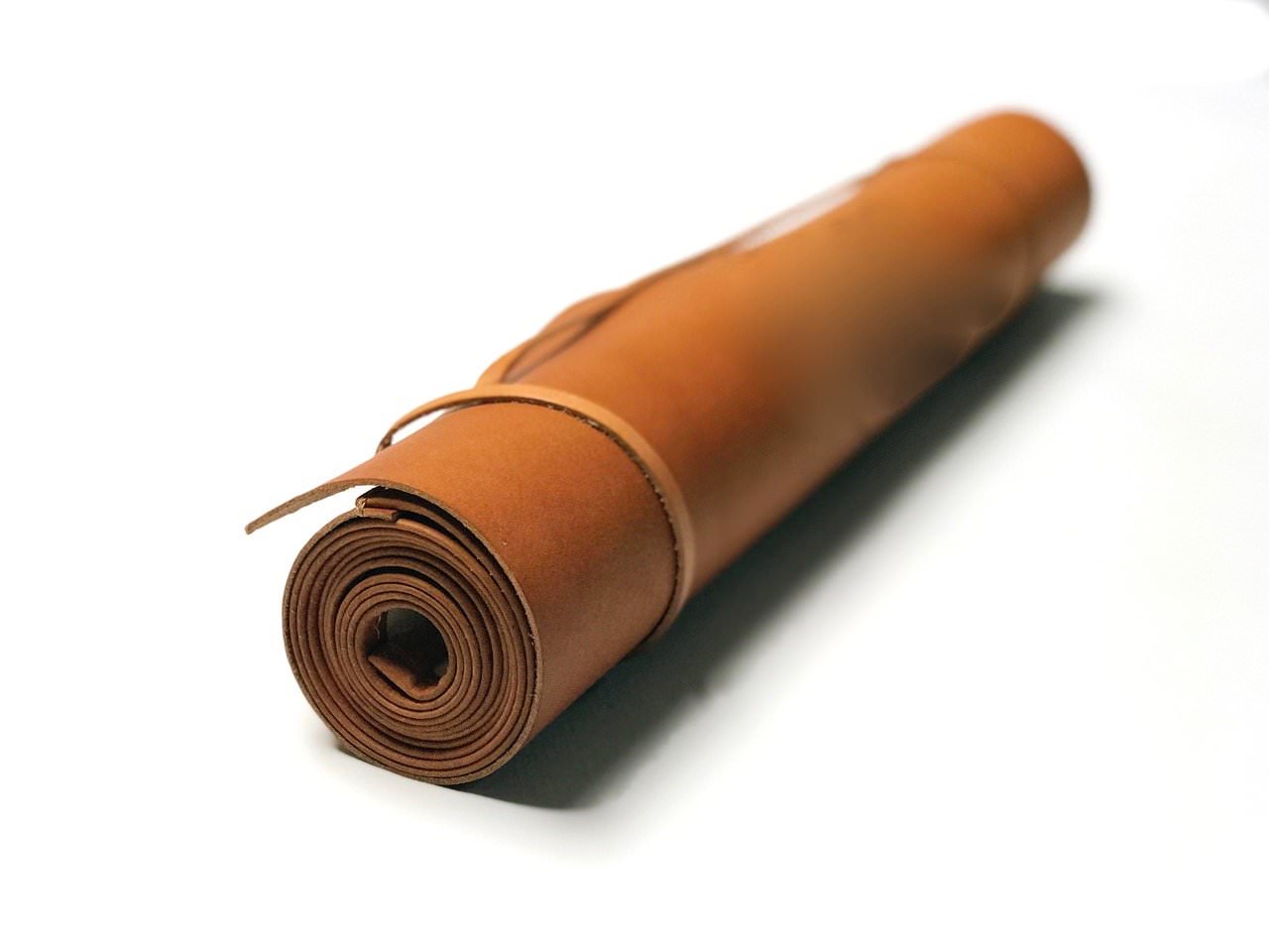
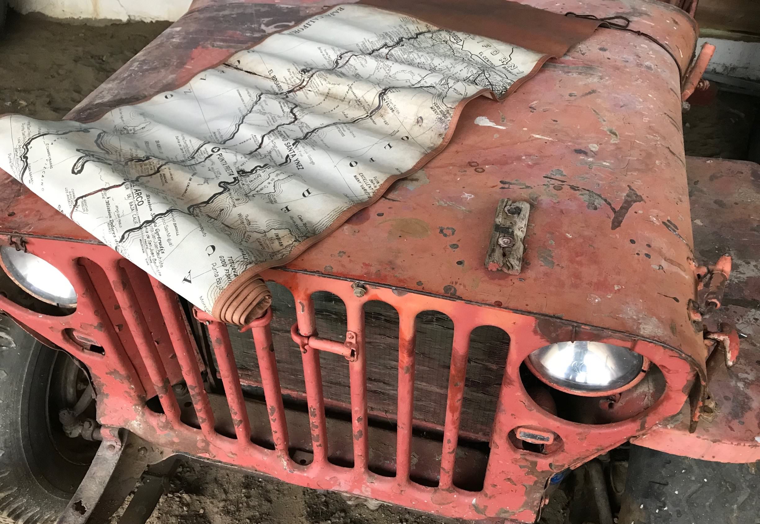
This is the leather bound scroll edition of the Baja Map, a roll-out map of the Baja Peninsula that includes all of the major cities, towns, landmarks, and roadways.
Although it’ll most often be used by those who buy it as a wall hanging, it’s designed to be actively used in the field. Each one is printed on museum quality canvas using lightfast inks and bound to a hand sewn and oiled leather scroll.
When unrolled it measures in at 17 x 60 inches or 1.5 feet by 5 feet long, that’s 43cm by 152cm. The length was designed to be perfect to unroll across the hood of a car, truck or 4×4 when you’re trying to figure out where you are, navigating the traditional way with maps and compasses from a time before GPS came along and made everything boringly easy.
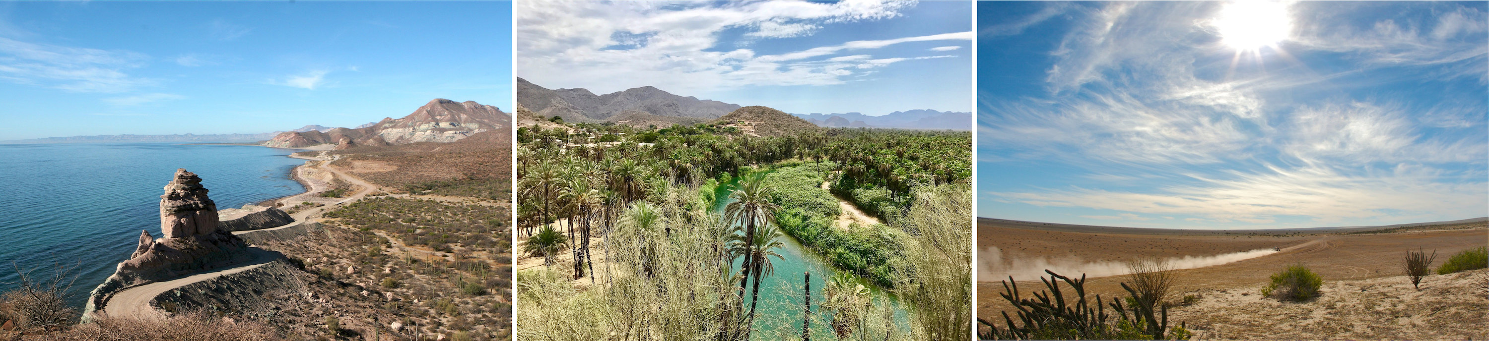
The Baja California Peninsula has been the location of some of the world’s great off-road races, the 775 mile strip of land in Northwestern Mexico boasts four main rugged desert areas including the San Felipe Desert, the Central Coast Desert, the Vizcaíno Desert, and the Magdalena Plain Desert. The terrain is some of the toughest in the world, and it’s broken some of the toughest machines ever built.
The Baja Map would make a great accompaniment for anyone wanting to navigate the peninsula the old fashioned way, and in the meantime it’ll make an excellent wall piece.


Articles that Ben Branch has written have been covered on CNN, Popular Mechanics, Smithsonian Magazine, Road & Track Magazine, the official Pinterest blog, the official eBay Motors blog, BuzzFeed, Autoweek Magazine, Wired Magazine, Autoblog, Gear Patrol, Jalopnik, The Verge, and many more.
Silodrome was founded by Ben back in 2010, in the years since the site has grown to become a world leader in the alternative and vintage motoring sector, with well over a million monthly readers from around the world and many hundreds of thousands of followers on social media.